Canyon de Chelly National Monument, AZ
South Rim Scenic Drive
Tunnel Canyon Overlook
To the right of the parking lot there is a short path to a stairwell that leads to a landing. Do not go beyond the sign without a permit and guide. The canyon at this point is about 275 feet deep. Note how various layers of rock in the small side canyon compare with the diagram of geological strata in Canyon de Chelly. The formations reflect a story of past environmental change in this region, from moist flood plains to Sahara-like deserts. Though rocks here are very old, Canyon de Chelly represents a recent geological development (less than three million years old). Prior to the uplift of this region, streams flowed westward out of the Chuska Mountains and meandered over a fairly flat plain. As the Defiance Plateau gradually rose, the grade of the streams increased. The more rapid flow carried boulders and sediment, cutting the canyon at the same time the area was being uplifted. Twists and turns of the canyon represent the original meanders of the "pre-uplift" stream. The sandstone cliffs of Canyon de Chelly embrace more than 200 million years of geologic history and 5,000 years of human history.
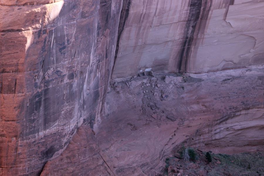
Desert Varnish
Long dark streaks mark the canyon walls. These streaks are part of a metabolic process in which microbes living on the canyon walls digest airborne minerals, resulting in stains left from manganese.
Chinle Formation
The top layer of rock and soils may be seen from the visitor center and the Tunnel Overlook. It is a highly colored, thin, soft deposit of Triassic Period silt and volcanic ash. It has eroded almost completely away from the rim. The Chinle Formation, also the formal name of the brightly colored hills that give the Painted Desert its name, can be seen in several other places, including Petrified Forest National Park.
Shinarump Conglomerate
This interesting rock layer, composed of stream-deposited sediments, makes up most of the rim. Grayish-brown cap rock deposited about 200 million years ago during the Triassic Period contains sandstone pebbles, quartz, basalt, chert, quartzite, and petrified wood.
De Chelly Sandstone
Forming from desert sand dunes, a layer of light red rock was deposited approximately 250 million years ago during the late Permian Period. Long sloping striations in this layer indicate winds that helped form the dunes came from the north. This distinct layer of rock is the most prominent rock seen in the canyons.
Supai Formation
The Supai formation formed about 280 million years ago during the Permian Period. It consists of layers of maroon-colored sandstone, silt stone, and mud stone. This layer of rock was deposited on low, flat flood plains, and is barely visible in the Spider Rock area.
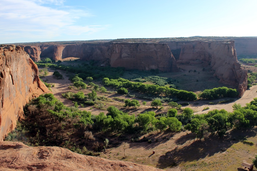
Tsegi Overlook
The Navajo home and farm in the canyon bottom below this overlook are used during warm weather. Horses and sheep usually graze in the canyon. You may also see crops such as corn, squash, peaches, and apples. During the summer months, the Chinle Wash runs visibly only following heavy thunderstorm activity. Through winter and spring months, the river runs almost constantly, due to snowmelt in the nearby Chuska Mountains. Most Navajo families leave the inner canyon during the cold winter months and move to the rim, where it is warmer. Many families also move to the rim at this time so their children may more easily attend school. Across the road from the overlook, at a distance of about one half mile, you can see the de Chelly sandstone formed millions of years ago.
Junction Overlook
On your left is First Ruin, the pueblo site described by archeologist Cosmos Mindeleff, who visited Canyon de Chelly in 1882. This dwelling contains rooms and two kivas (ceremonial rooms). Like most other structures of this type, it was occupied between the late 1000s and early 1200s. Straight ahead on the far side of the canyon, look for Junction Ruin. It gets its name from its location at the junction of Canyon del Muerto and Canyon de Chelly. It consists of rooms and one kiva. A majority of the larger cliff dwellings are on the south-facing wall of the canyon. Here sunlight provided warmth and plenty of light for daily activities, even during winter.
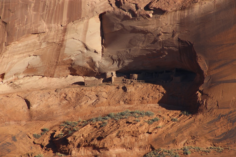
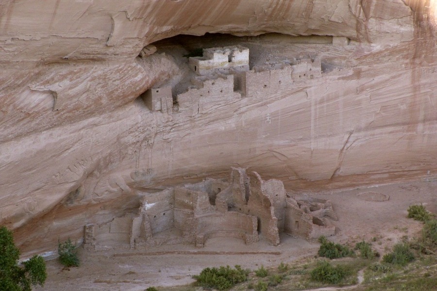
White House Overlook
Across the canyon from this overlook look for a village that once housed more than a dozen families sitting in the canyon wall. White House Ruin was constructed in two sections: the cliff dwellings in the alcove and the masonry pueblo on the canyon floor. The Navajo call this site Kinii'ni gai or "white house in between", referring to the white plastered walls of the room built in the alcove. The multi-storied pueblo below was once high enough to provide access to the rooms in the alcove above.
The site may have had up to eighty rooms and at least four kivas, but due to erosion only about forty rooms are left. Tree-ring dates from the logs used in the construction indicate the first building activity began around CE 1060, with additions as late as CE 1275. People who lived here planted crops and gathered fruits and nuts from wild plants. They hunted deer and rabbit with bows and arrows to supplement their diet. They utilized other plants for fiber to make cords, baskets, and mats, and others for dyes. They were able to use local vegetation for medicinal use and other purposes. The trail to White House Ruin begins 150 yards to the right of the overlook. Use caution when hiking this switchback trail. Remember that all hiking in the canyon bottom, with the exception of this trail, requires a guide and permit. Do not go beyond White House Ruin on your hike.
Sliding House Overlook
Thin gravel deposits overlying the sandstone here are remnants of the Shinarump Conglomerate. Shallow basins eroded out of the sandstone surface collect water during summer rainstorms. The largest cavities may hold water for several weeks or from one storm to the next. Following rainstorms, Navajo and prehistoric people used to gather fresh water from the natural basins.
Sliding House Ruin, located on the narrow ledge across the canyon, is aptly named. The sloping floor of the ledge was compensated for by the construction of retaining walls. Built by early Pueblo people, these walls were engineered to keep their home from sliding into the canyon. Kinaa zhoo zhi, Navajo for the "house that is sliding"; had up to fifty rooms and three kivas and was built around CE 900 and occupied through the mid-1200s.
Face Rock Overlook
This short path leads to the overlook where you can see four small sites through the viewfinder. Notice the difference in location of these ruins. To the far right is the outline of Face Rock, the pinnacle facing Spider Rock. According to Navajo oral history, Face Rock reports the names of misbehaving children to Spider Woman.
Spider Rock Overlook
Follow the sidewalk about 200 yards to the overlook. The floor of the canyon is about 1, 000 feet below. To the right is Monument Canyon, which joins Canyon de Chelly. Spider Rock, or Tse na'ashje'ii is the most prominent landmark in this area. At 800-feet tall, it stands at the junction of the two canyons. Face Rock is to the left on the far side of Canyon de Chelly. The Navajo believe that Spider Woman, the deity who taught the Navajo women how to weave, lives atop Spider Rock. It is also believed that once Face Rock informs Spider Woman of naughty children, she carries the children to the top of Spider Rock.
With good eyes or a pair of binoculars, a number of dwellings can be seen from this overlook. At the base of Spider Rock are several small Navajo structures. Look for other evidence of early architecture across the canyon in alcoves and on ledges to the far left of the overlook.