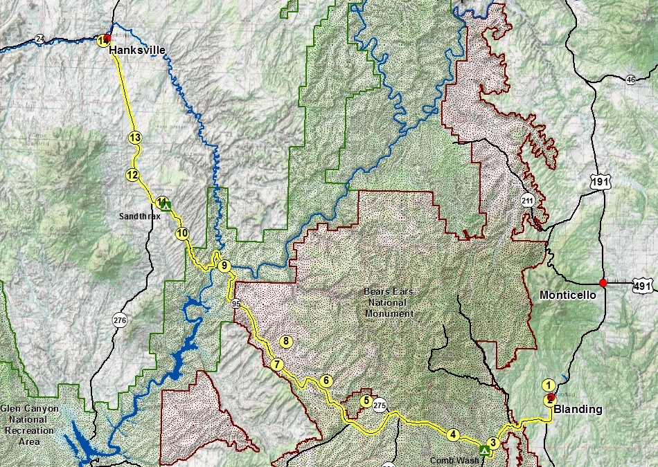
Completed in 1976, Utah's Bicentennial Highway Scenic Byway (State Route 95 and portion of US 191) runs 126 miles from Blanding to Hanksville. A portion of this scenic byway (approx. 30 miles) overlaps the Trail of the Ancients Scenic Byway.
Blanding
Blanding is the gateway to Utah's Canyon Country. Surrounded by more state and national parks than anywhere else in the United States, Blanding is the perfect base camp for your adventure.
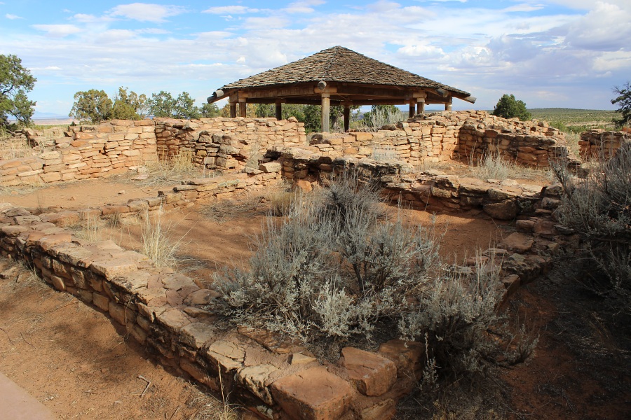
Edge of the Cedars State Park museum houses the largest collection of Ancestral Puebloan (Anasazi) pottery in the Four Corners Area. The museum was built at the site of an ancient village which included dwelling units and a kiva. The kiva and some other structures have been restored and can be viewed behind the museum. The museum offers programs for adults and children, including archeology and art exhibitions, storytelling, and craft workshops. (Trail of the Ancients Scenic Byway #8)
Edge of the Cedars State Park: Inside restored Kiva.Photo by EMKotyk
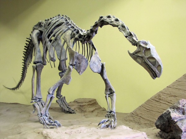
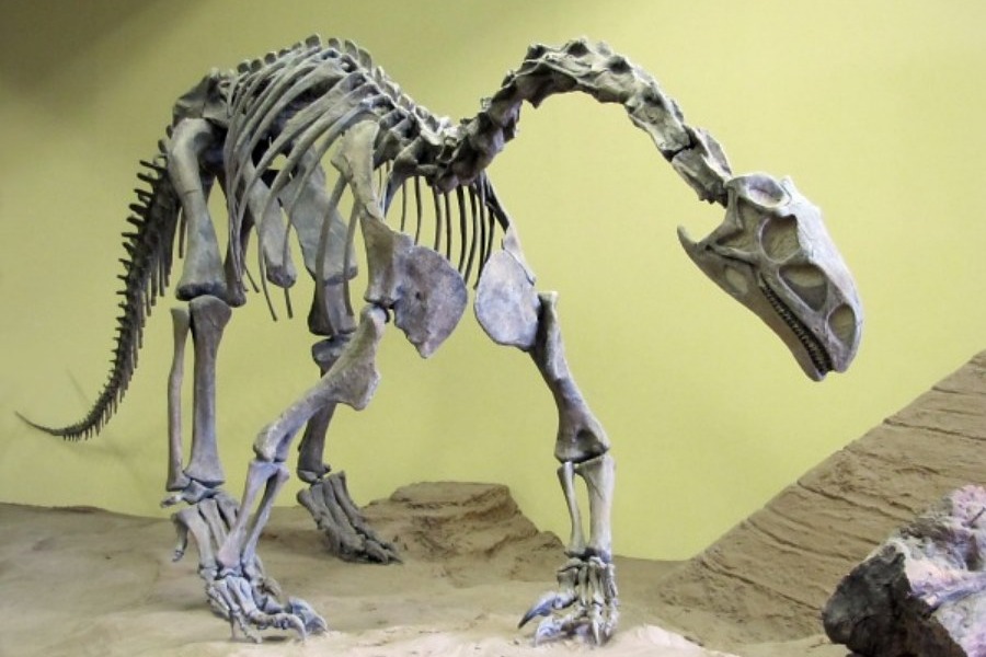
The Dinosaur Museum exhibits a complete history of the world of dinosaurs. Skeletons, fossilized skin, eggs, footprints, state-of-the-art graphics, and beautifully realistic sculptures present the dinosaurs from the Four Corners region. (Trail of the Ancients Scenic Byway #7)
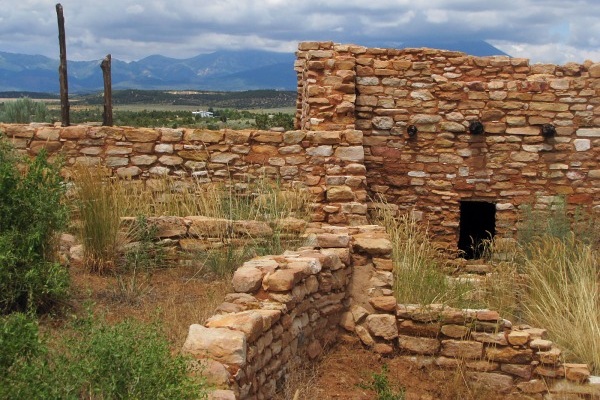
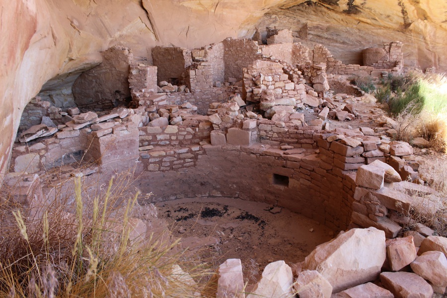
Location is signed on the west side of State Highway 95. A cliff dwelling located in a side canyon of Butler Wash, the ruins were built and occupied by the Ancestral Puebloans, around 1200 AD. Parts of the site has been stabilized and reconstructed, but most of it remains as it was found in the 1800s. There are habitation, storage and ceremonial structures, including four kivas. in a side canyon of Butler Wash, on the east side of Comb Ridge. (Trail of the Ancients Scenic Byway #9)
Butler Wash Ruins.
Mule Canyon Ruins
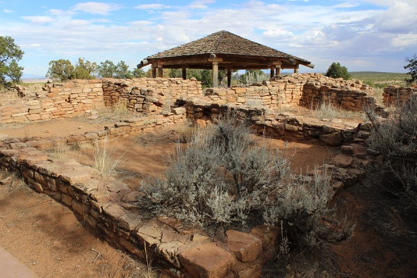
Signed and located directly off of State Highway 95, this is a set of ruins that have been stabilized by the Bureau of Land Management. The ruins were occupied from about A.D. 750 to 1150 (Pueblo I to Pueblo III period). Facilities at this location include a vault toilet, seating, and several educational panels explaining the history and traditions of the Ancestral Puebloans.
Mule Canyon Ruins.Photo by EMKotyk House on Fire Ruins
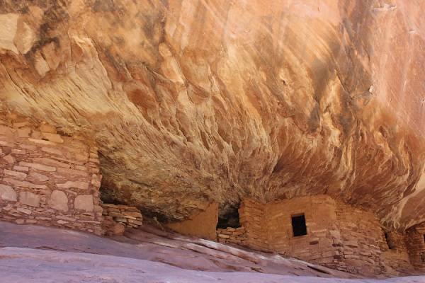
Access to the trailhead is about 1/3 of a mile east of the Mule Canyon Ruins turn off to the BLM exhibit of Mule Canyon Ruins. Located in the south fork of Mule Canyon, these ruins were occupied around the same time as Butler Wash Ruins. A more back country hiking experience of about a 3 mile round trip hike, these ruins are popular for photographers due to the colors and lighting, especially in the morning. (Trail of the Ancients Scenic Byway #10)
House On Fire Ruins.Photo by EMKotyk
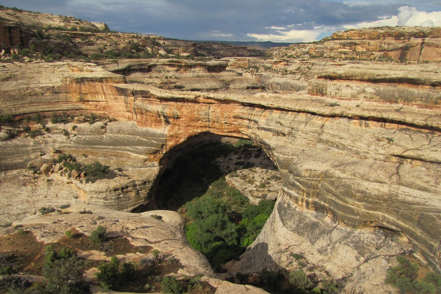
Declared a National Monument in 1908, three majestic natural bridges are named "Kachina," "Owachomo" and "Sipapu" in honor of the Native Americans that once made this area their home. View them from an overlook, or hit the trails and experience their grandeur from below. (Trail of the Ancients Scenic Byway #11)
Natural Bridges National Monument: Sipapu Bridge.Photo by EMKotyk
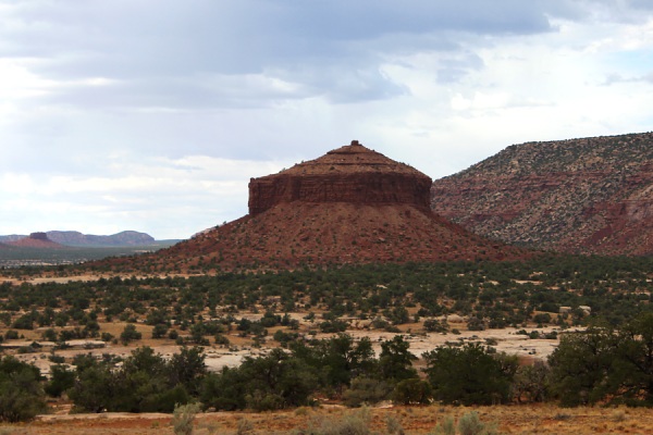
Sign along State Highway 95 points to the Cheese Box Butte, one of the most distinctive landmarks along the scenic byway.
The Cheese Box Butte.Photo by EMKotyk
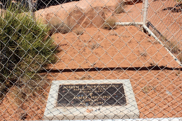
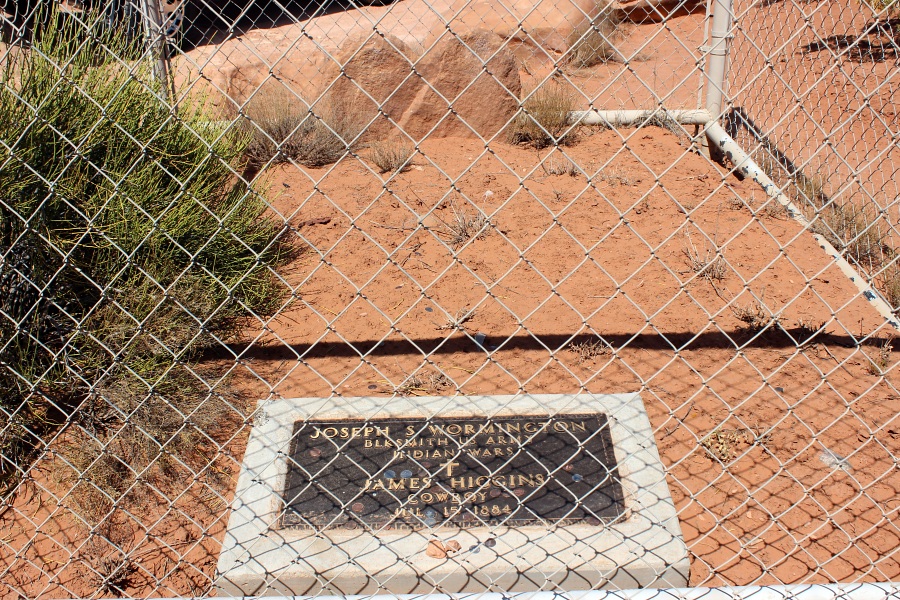
Sign alongside State Highway 95 points to a turn off to see a Historic Marker. At this location is a fenced sandstone headstone along with a plaque and metal sign describing a historic battle which occurred in the canyon below. From the hand welded sign reads the following:
ON JULY 15, 1884, A U. S. CALVARY SCOUT NAMED JOSEPH S. WORMINGTON AND A COWBOY NAMED JAMES "ROWDY" HIGGINS WERE KILLED IN A BATTLE WITH INDIANS AT NEARBY PAIUTE PASS. THESE MEN WERE PART OF A POSSE OF CATTLEMEN AND SIXTH CALVARY - F - TROOP SOLDIERS FROM FORT LEWIS, COLORADO WHO WERE CHASING A BAND OF RENEGADE UTE AND PAIUTE INDIANS LED BY MANCOS JIM. THE INDIANS HAD STOLEN 150 HEAD OF HORSES FROM THE ROUND-UP GROUNDS IN VERDURE, UTAH. AFTER A 75 MILE CHASE THE UTES AND PAIUTES LED THE POSSE AND SOLDIERS INTO AN AMBUSH. TWO MONTHS AFTER THE BATTLE, PROSPECTORS CASS HITE AND JOE DUCKETT FOUND AND BURIED THE REMAINS. THE UTES AND PAIUTES WERE WATCHING THE U. S. GOVERNMENT ABSORB THEIR HOMELANDS. THEY FOUGHT BACK IN THE ONLY WAY THEY KNEW HOW. THE SOLDIER GAVE HIS LIFE IN THE SERVICE OF HIS COUNTRY. THE COWBOY DID THE TOUGH JOB HE WAS PAID TO DO AND A LITTLE MORE. ALL OF THEM PLAYED OUT THEIR HEROIC ROLES IN THIS EPOCH STRUGGLE TO SETTLE THE OLD WEST.
Battle of Paiute Pass.Photo by EMKotyk
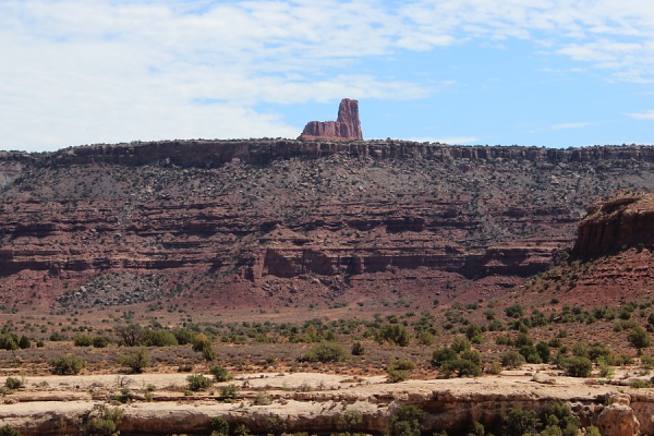
At a certain perspective, this butte looks like an chair. Measuring 270 feet high, it was first reportedly ascended by George Hurley and Bill Forrest in November, 1976.
Jacobs Chair.Photo by EMKotyk
Glen Canyon National Recreation Area
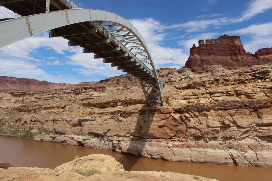
The Bicentennial name arose when the construction of the Hite's Crossing Bridge and highway paving were completed on time for the nation's bicentennial year (1976). The original crossing at the Hite area was flooded after the construction of the Glen Canyon Dam and the creation of Lake Powell. The road realignment, bridge and other improvements modernized a 40 year old roadway. Hite Overlook is located another 6 miles further up the road and is signed.
The location is named after Cass Hite, a gold prospector and explorer of the Colorado River in the Glen Canyon area in the late 1800s. Hite died in 1914.
Hite Crossing over the Colorado River.Photo by EMKotyk
Bureau of Land Management Lands
Located on the west side of State Highway 95, this rest area has vault restrooms and some picnic facilities.
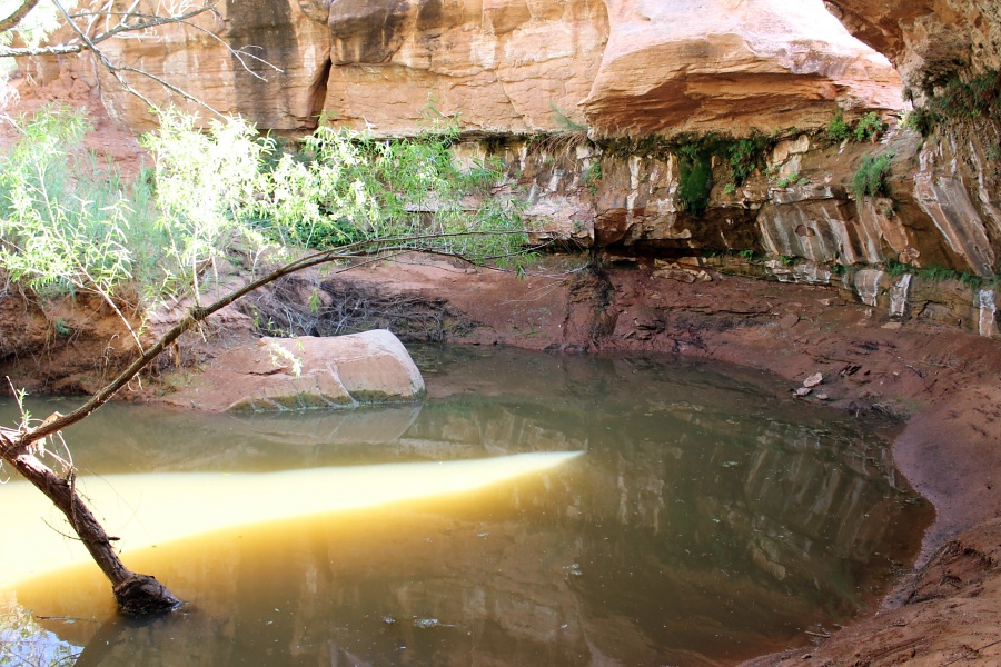
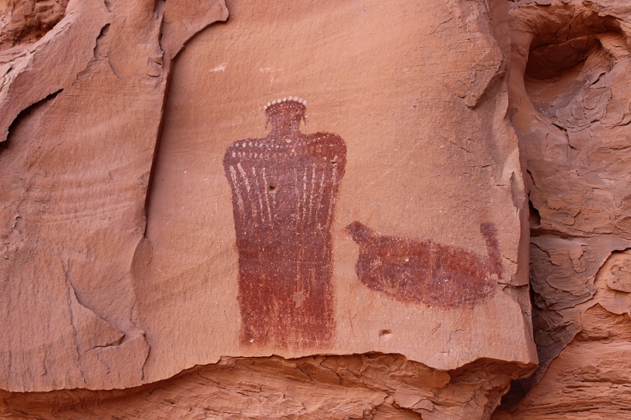
Crossing the bridge over North Wash allows one to follow a trail 1 mile north to Hog Springs, a plunge pool that is often murky in the summer months when the stream is not flowing. Further south from the rest area about 200 ft is an alcove with a pictograph panel commonly called the "Moki Maiden." This rock art shows a woman and a turkey.
Further south, is access to Hogwarts Canyon which is a mini slot canyon with an arch. This canyon requires repelling to reach the various levels.
Hog Springs.Moki Maiden with Turkey.Photos by EMKotyk
Commonly referred to as the Irish Slot Canyons (Shillelagh, Blarney, and Leprechaun canyons), these canyons vary in difficulty for beginners to experts. These canyons can be explored by most skilled hikers at the beginning of the canyons but as one progresses deeper into the canyons, technical gear and repelling is required.
Shillelagh: This is the shallowest of the Irish Slot Canyons, fun to explore and technically challenging, requires full technical gear. (38.027759, -110.546884)
Blarney: The 4.5-mile round trip Blarney trail is a technically challenging hiking and canyoneering adventure. Blarney slot canyon forks into two narrows, one of which is extremely challenging and requires technical gear. Lower Blarney canyon is an easy hike with long stretches of narrows and great photo ops. This slot canyon is rated 3A and known for flash flood danger. (38.02414, -110.543006)
Leprechaun: Leprechaun is the longest of the Irish Slot Canyons and one of the most difficult to explore depending on the route you choose. (38.026900, -110.531300)
As you past the turn-off to Bullfrog Marina, there will be a large mesa on the west side of the highway which is called "Little Egypt." The formation was named by early cowboys who were reminded of the Egyptian Sphinx.
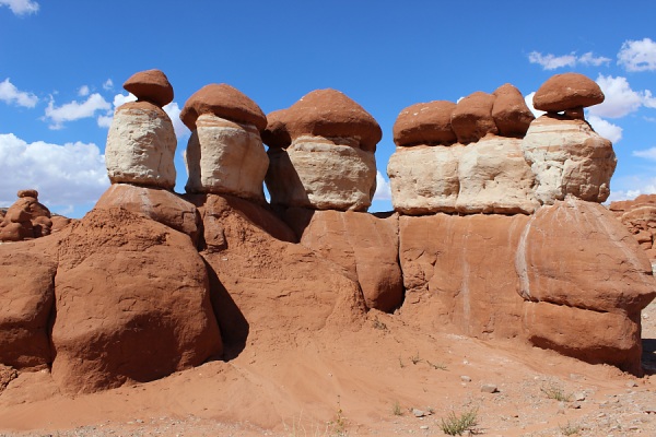
Taking a dirt road west off of the highway, just past mile markers 21, will lead one into an unusual landscape of red and white banded sandstone of small hoodoos and oddly shaped formations. This area is a brief glimpse of a more stunning Goblin Valley State Park located 20 miles north of Hanksville.
Little Egypt.Photo by EMKotyk
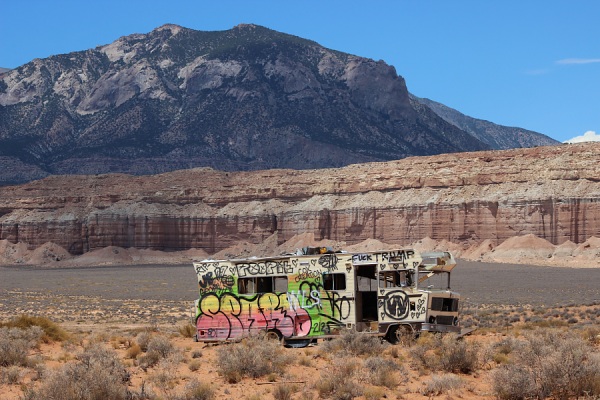
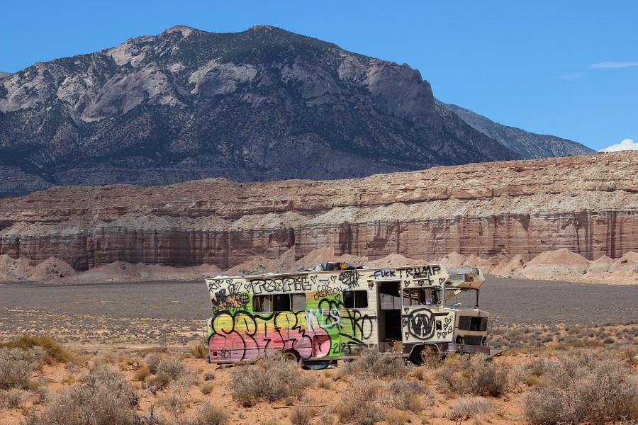
As you approach Hanksville (between mile markers 15 & 16) on the west side of the highway will be visible an old RV ("the Magic Bus") that has been creatively painted and tagged by numerous individuals.
Magic Bus.Photo by EMKotyk
Hanksville
Located within the heart of Utah's National parks, Hanksville is a small town which offers the necessary amenities to allow for a comfortable stay to explore the surrounding sights of Lake Powell, Goblin Valley, and Capital Reef.
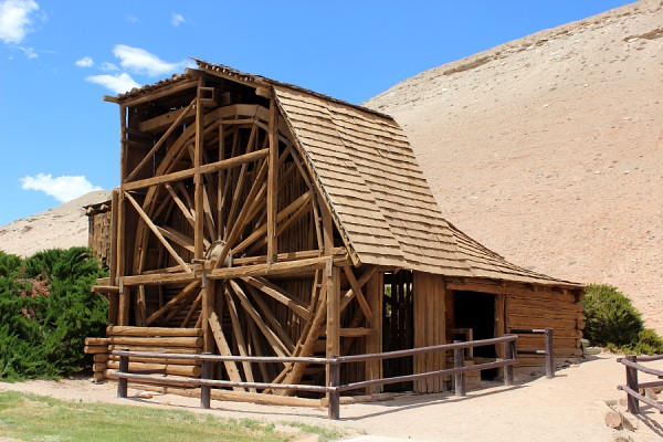
The Wolverton Mill is a log structure built by Edwin T. Wolverton in 1921. Functioning to mill wood and crush ore it was one of a handful of mills in the country to do both of these functions. Once located in the Henry Mountains, the mill was disassembled and restored and is now located at the Bureau of Land Management Office in Hanksville.