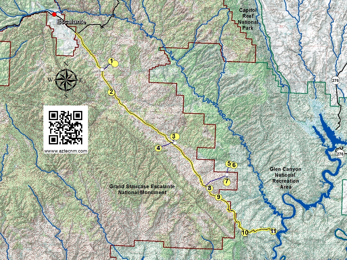
The Hole-In-The-Rock Scenic Backway is a 55 mile drive that leads one from Scenic Highway 12 south of Escalante to Lake Powell. Attractions lie within either the Grand Staircase Escalante National Monument or Glen Canyon National Recreation Area. The first 35 miles of the main road is accessible via high clearence two-wheel drive vehicles when weather conditions are dry. Beyond 35 miles and side access roads may require four-wheel drive vehicles, especially with wet conditions.
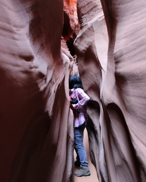
Location of this locale is not signed, but a parking area is visible on the west side of the Hole-in-the-Rock Road adjacent to a fence line (approx. 8.0 mi from the Highway 12). Cross the road to the east to access the trail which is an approximate 2 mile easy-moderate hike to the entrance of Zebra Canyon. Zebra Canyon, named for its alternating pattern of pink and white stripes is a photographer's delight. Further east about 1-1/4 miles along Harris Wash, one can get access to Tunnel Slot Canyon. The "tunnel" is a long narrow slot over 200-ft. long that is usually filled with water. Much of this route is exposed with little or no shade. Be sure to carry plenty of water. The route is best hiked in the spring and the fall.
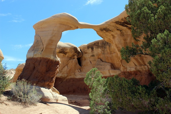
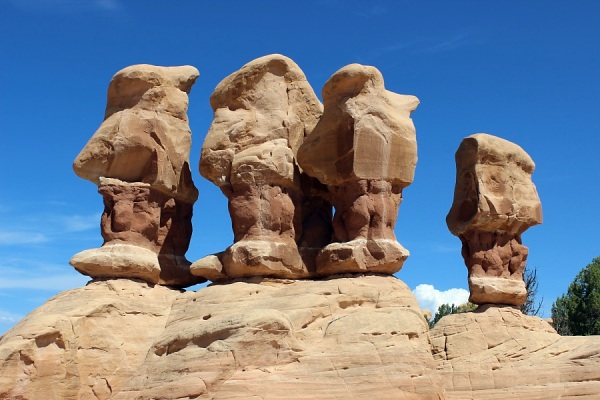
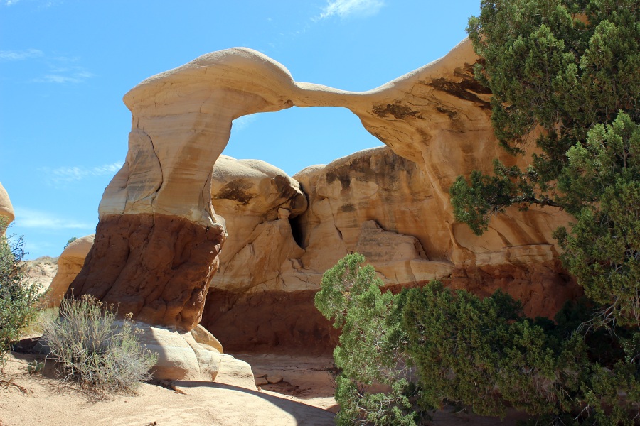
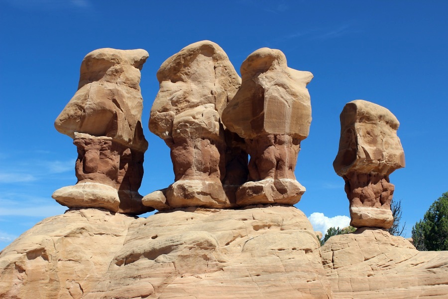
This location is signed and a simple 1/4 mile detour off of the road will get you to the parking lot of Devil's Garden. Designated by the BLM as an Outstanding Natural Area, the unusual shaped hoodoos, domes, and small arches are a sight to see.
Most commonly photographed are Metate Arch, Mano Arch, and what is sometimes referred to as the "Three Macaws" or "Three Brothers and A Sister" hoodoos. There are plenty of hoodoos and oddly shaped formations that one only has to let their imagination wonder.
An informational kiosk, vault toilets, and picnic tables are available at this location.
Devil's Garden: Metate Arch.Devil's Garden: Mano Arch.Devil's Garden: Three Brothers & Sister Hoodoos.Photos by EMKotyk
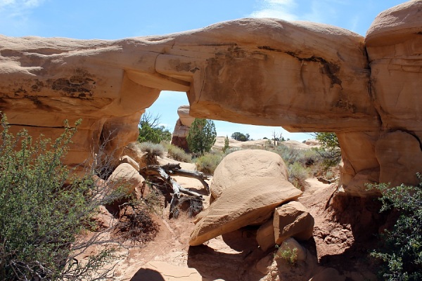
This location is signed and a 0.7 mile detour off of the road will get you to the parking lot. The trail is about 1 mile along an old road and then another 0.6 miles along a trail to the head of Peek-a-Boo Canyon.
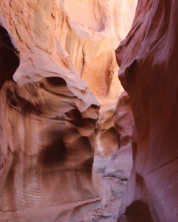
Spooky Canyon is located 0.5 miles further downstream along Coyote Gulch. It is a very challenging hike and in some areas of the slot very narrow!
Dry Fork Canyon which is less talked about but just as interesting is located immediately left as you enter Coyote Gulch before heading to Peek-a-Boo.
No shade is available along the hikes to each canyon, so bring an umbrella and plenty of water. No facilities at this location.
Peek-a-boo Slot Canyon.Spooky Slot Canyon.Dry Fork Slot Canyon.Photos by EMKotyk
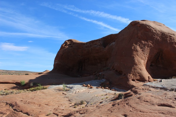
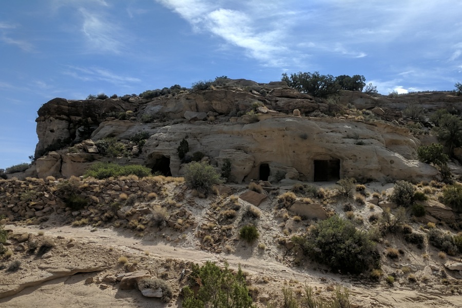
This location is not signed and the access road to this location is immediately opposite to the slot canyons access road.
Four-wheel drive is highly recommended as there is a wash that has to be crossed (at 1.7 miles) to get to the site. Otherwise, a regular vehicle will have to park at the wash and a hike of 0.6 miles is required.
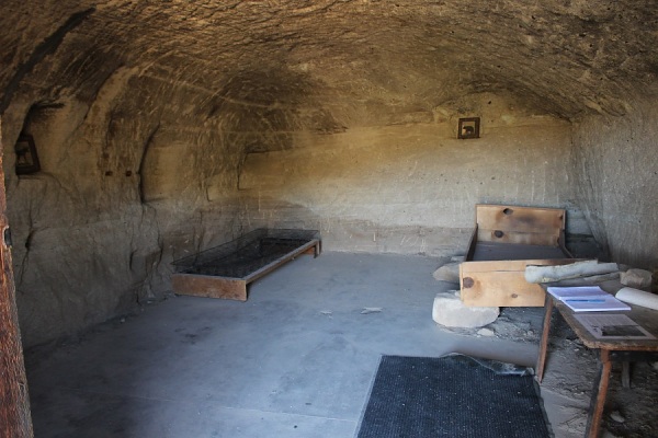
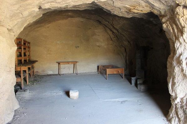
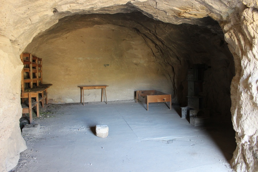
The site is considered a "Restoration Site" by the BLM. It consists of three shallow, man-made caves, an old abandoned vehicle, with some equipment and furnishings still remaining.
The story about these caves is that two brothers, Bill and Cliff Lichtenhahn in the 1950s and 1960s, carved out these three caves for their living quarters and two workshops. The brothers created table tops checkerboards, and other articles out of petrified wood, jasper and other stone. Inside the living quarters, one can find a laminated news article "Modern Cave Dwellers" that talks about the brothers.
Batty Pass Caves.Batty Pass Caves: Living Quarters.Batty Pass Caves: Work Quarters.Photos by EMKotyk
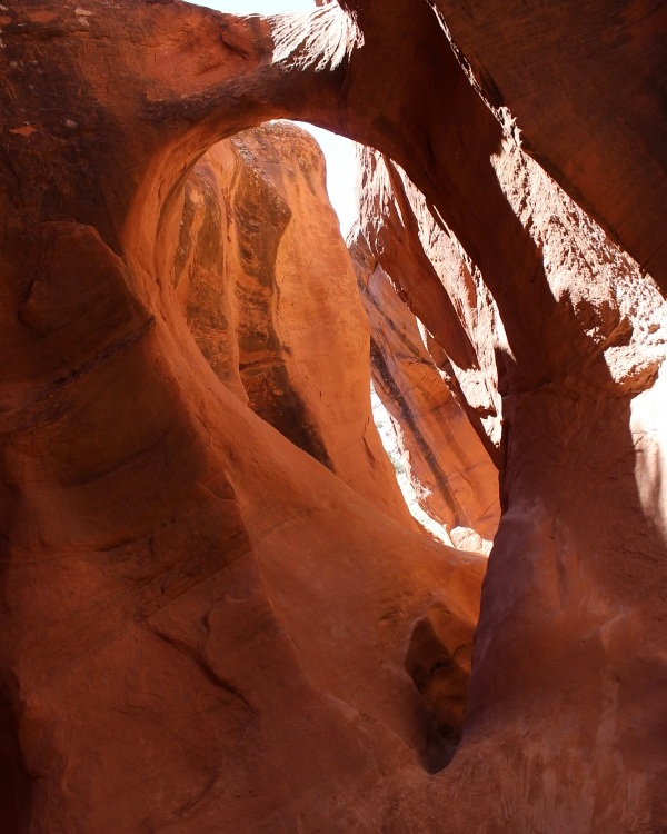
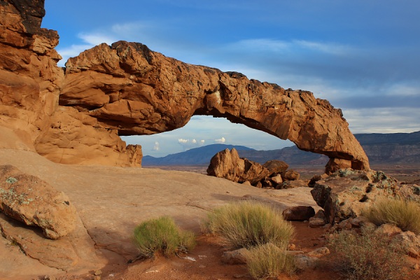
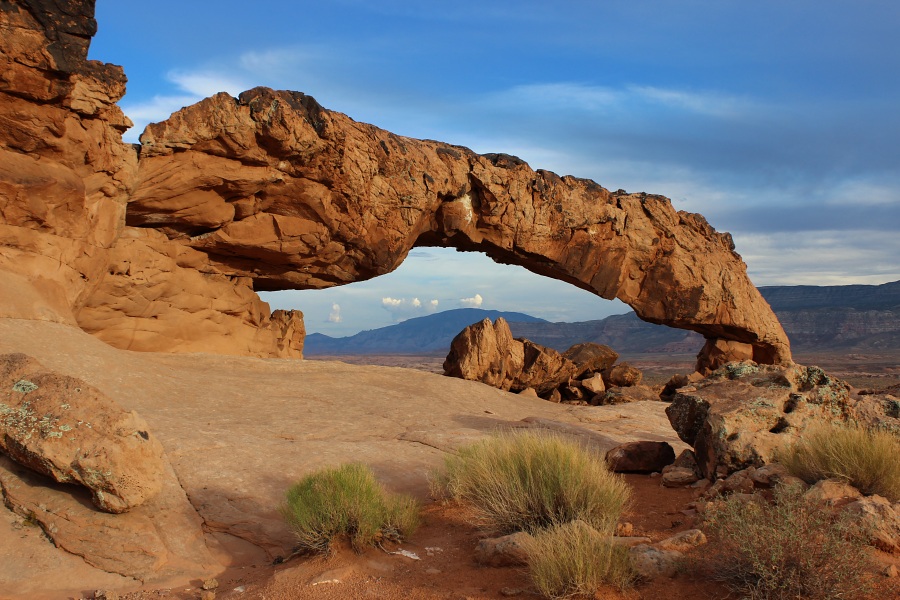
Access to the location is not signed, but there is a sign for "Forty-mile Ridge" off of the main road that one turns onto to reach the remote parking area at the well tank.
Considered by some as one of the most beautiful arches in Utah, this 100 ft tall and 150 ft wide arch is located in Coyote Gulch of the Glen Canyon National Recreational Area. There are three traditional trails that lead to this arch. The shortest and most direct trail is off of Forty Mile Ridge Road from the water tank which is a 2.1 mile one-way trip. Other trails include Red Well (8.5 miles one-way) and Hurricane Wash (7 miles one-way). The trails from the bench into the canyon is very steep but can be traversed with good traction shoes.
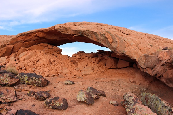
Coyote Natural Bridge is located 1.5 miles further downstream from Jacob Hamblin Arch. This arch is smaller but as picturesque with the stream running through it.
Access to the location is not signed, but there is a sign for "Forty-mile Ridge" off of the main road that one turns onto to reach the remote parking area.
There is no formal trail established to reach Sunset and Moonrise Arches. However, heading due south from the water tank along the crest of the ridge will get you in very close proximity. Once you encounter slick rock, stay on it along the highest points to reach Sunset Arch. From Sunset Arch you can see Sunrise Arch (aka Moonrise Arch) which is located further south about 1,000 feet.
Sunset Arch.Moonrise Arch (aka Sunrise Arch).Photos by EMKotyk
Access to the location is signed and immediately off of the main road with an established parking lot, info kiosk, vault toilet facility, and gravel trail.
Dance Hall Rock is a large natural sandstone amphitheater. On their way to establish a settlement, Mormon pioneers in 1879-80 spent two months waiting for a road to be built to the Colorado River. Dance was an important part of Mormon society, and the good acoustics of the natural stone amphitheater appealed to the pioneers.
Dance Hall Rock.Photo by EMKotyk
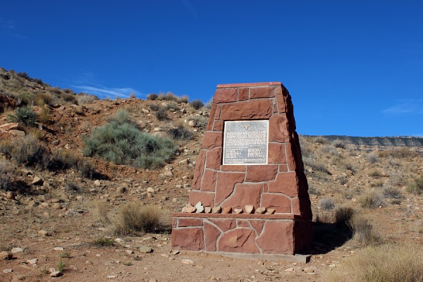
At this location, one will find a memorial monument, immortalizing the lives lost in a tragic accident that occurred in 1963. A group of 49 people set out on an expedition to run the Colorado River from Hole-in-the-Rock and Glen Canyon. The open truck stalled on its ascent up the slope, the brakes failed, and the truck rolled backwards, overturned, and continued to roll. Thirteen people (seven youth and six adults) lost their lives here. The plague goes onto name the individuals.
Carcass Wash Memorial.Photo by EMKotyk
No signage at this location. But it is after this point that travel requires four-wheel drive as one crosses slick rock and gulleys to get to Hole-in-the-Wall.
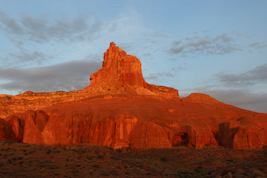
Just 1 mile north of this point is Fifty Mile Spring. It is at this spring that the first child on the Mormon Expedition was born.
Fifty Mile Point at sunrise.Photo by EMKotyk
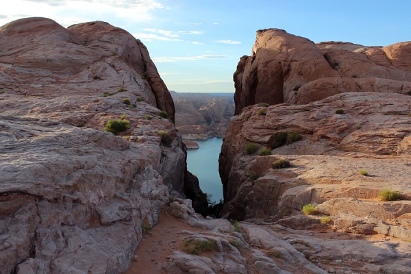
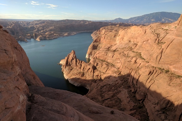
Other than a plaque and info kiosk, there are no other facilities located here. One may hike down to Lake Powell. However, the trail is very strenuous and is not maintained. You should be in good physical shape and have experience hiking over rough and uneven terrain.
History The expedition of members of the Church of Jesus Christ of Latter Day Saints made use of the Hole-in-the-Rock cut to cross the Colorado River in 1880. Construction of this passageway was very difficult. The workers were plagued by lack of wood, forage for cattle, bitter cold, and diminishing food supplies. Blasting powder and picks were used to widen and/or fill various sections of the crevice. At the lower part of the Hole, a road was constructed on the side of a sheer cliff wall. Although a three-foot shelf had already existed, an extension to the shelf was formed by driving two-foot stakes into the rock and piling vegetation and rocks on top. This portion of the trail was nicknamed "Uncle Ben's Dugway" in honor of its engineer, Benjamin Perkins. After six weeks of picking, chiseling, drilling, blasting, and digging, the Hole-in-the-Rock road had been completed.
Hole-in-the-Rock.View of Lake Powell from above the Hole-in-the-Rock.Photos by EMKotyk