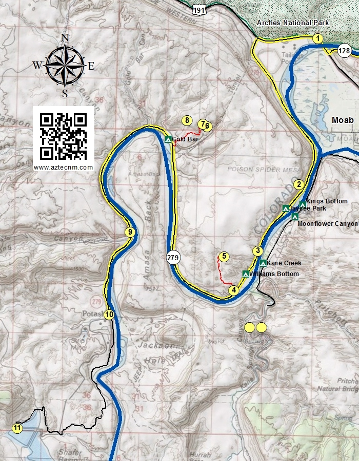
The Lower Colorado River Scenic Byway follows Utah State Hwy 279 from Moab to the Intrepid Potash Mine, approximately 15.0 miles along the Colorado River.
UT 279
Located just north of the intersection of UT 128 and US 191, is a place to park and walk along the bike path to Courthouse Wash Rock Art.
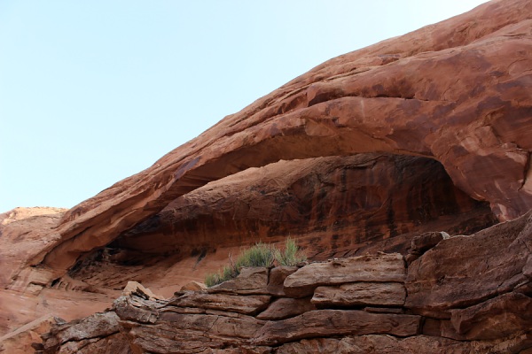
A small arch located on the west side of the highway. Not easily visible unless one takes the 4x4 Poison Spider Mesa Trail.
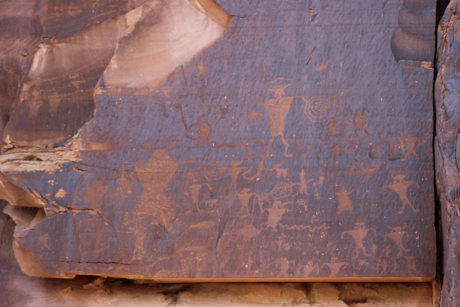
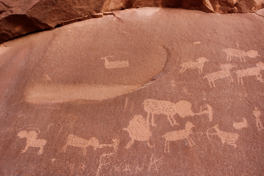
Several petroglyph panels are located along the cliff side. Signage and areas to pull off the highway are available for viewing the petroglyphs.
Photo by EMKotyk
This location provides a vault toilet and an informational kiosk providing trail information to the Poison Spider Dinosaur Tracksite, Rock Art, and Long Bow Arch trails.
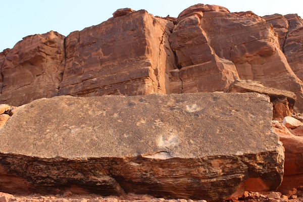
There are two slabs that have dinosaur tracks. The tracks are from Eubrontes and Grallator meat-eating dinosaurs that existed ~190 million years ago in the Jurassic Period.
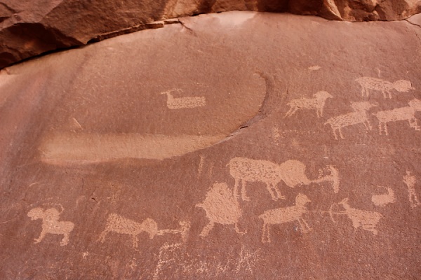
Along the base of the cliff are several panels of petroglyphs. The petroglyphs are of Fremont style and consist of anthromorphs and various quadroped animals such as big horn sheep and deer. One of the panels seems to be depicting a hunt.
Photos by EMKotyk
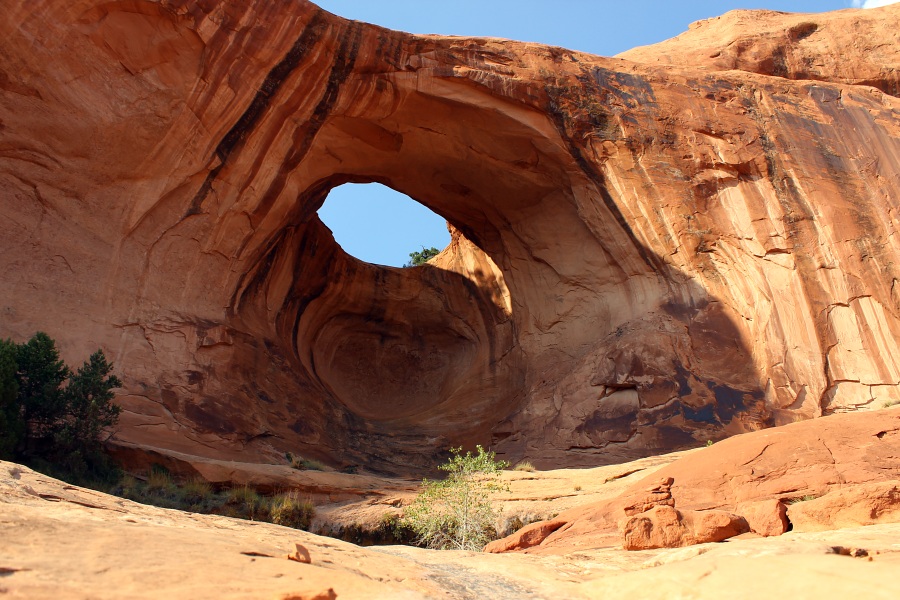
Accessible by an approximate 1.2 mile hike (one-way) from the Poison Spider Trail parking area. The trail the arch is well marked with green dot/dash spots and foot trail through the sandy drainages. Long Bow Arch is approximately 50 ft high with a span of 110 ft.
Photo by EMKotyk
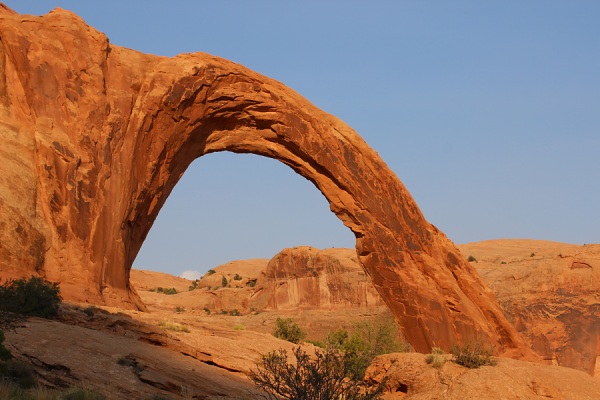
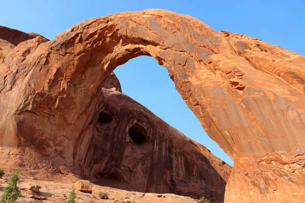
Located in Bootlegger Canyon, Corona Arch is an old buttress arch formed in the Navajo sandstone formation. The arch spans 140 feet with a height of 105 feet. The trail is approximately 2.5 miles round trip from the parking lot to Corona Arch. This arch provides for many photographic aspects depending upon the time of day and direction.
At a certain angle, one can see the Eototo (Hopi Chief Kachina) peer out through the arch.
Photo by EMKotyk
Located on the same trail to Corona Arch, it can often be photographed with Corona Arch at the ladder and Moki steps along the trail.
Photo by EMKotyk
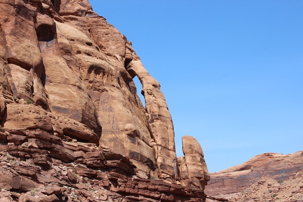
Located north of the Corona Trail, access to this arch requires some rock climbing as it is not easily accessible.
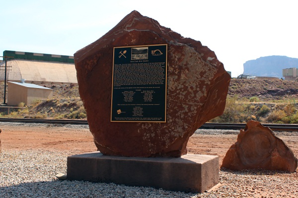
Located adjacent to the highway just before the Intrepid Potash Mine.
Photo by EMKotyk
(Information from the Memorial Plaque)
Early in 1961, Texas Gulf Sulpher Company, the original owners of the Cane Creek Potash Mine (located just west of this marker), contracted Harrison International, Inc. to sink the shaft and develop the underground mine to access sylvite (potash) ore thousands of feet below the surface, On August 27, 1963, at 4;40 PM, a devastating methane gas explosion occurred nearly 3,000 feet below in the mine. At the time of the explosion twenty-five Miners were working underground, Eighteen of those miners were killed, either outright from the blast or by smoke inhalation. Ten of the miners initially survived the explosion, As these men headed towards the shaft station to escape they were forced to turn back due to white smoke rolling towards them. The only option was to head to the deepest part of the mine, which was just over 3,000 feet from the shaft station, and construct a barricade. Only seven miners made it to the barricade, After fifteen hours, two of the survivors, Hanna and McKinney, left the barricade and made their way to the shaft station, For several hours they repaired a portion of an airline near the shaft blown out by the blast with the hope that the much needed air would make it back to the men they haft behind in the barricade, After a while, Hanna and McKinney were able to make contact with a rescue team. This team was making their way in an ore bucket clearing a way down through the debris which was stacked up at the bottom of the shaft from the explosion so that following rescue teams could get into the mine and begin the search for survivors. The other five miners behind the barricade were later rescued on August 29, 1963, over fifty-hours after the explosion.
In honor and memory of the eighteen miners who 'perished and the seven who survived:
Deceased:
Wesley J. Barber
Myrien H. Christensen, Sr.
Lawrence L Davidson
James N. Hollinger
Ciell Johnson
Emile J. LeBlanc
Fred 0, Rowley
Lamar C. Rushton
Peter Sviscsu
Robert Wayne Bobo
Myrien H. Christensen, Jr.
Jesse E. Fox
William Huzil
Jesse C. Kessler
Kenneth Milton
Joseph Rene Roy
Keith Schear
John B. Tinall
Survivors:
Charles W. Byrge
Charles C. Clark
Grant S. Eslick
Donald Blake Hanna
Robert E June
Paul McKinney
Thomas J. Trueman
Memorial erected June 2014 by Intrepid Potash, Inc., current owner and operator of the Cane Creek Mine, The underground mine was converted to solution mining in 1970.
Photo by EMKotyk
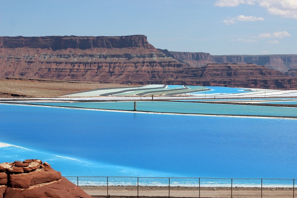
Although not considered as part of the Lower Colorado Scenic Byway, an additional 5 mile trip on a dirt road will take you to an unusual view of strange blue ponds.
These man-made ponds are for collecting potash, a potassium-containing salt used in farm fertilizers. A briny solution of salt and water is pumped into deep injection wells. The brine dissolves the potash, leaving other minerals in the rock 2,400 to 4,000 feet underground undisturbed. The mixture of brine, water and dissolved potash is pumped back up into the evaporation pools. The evaporation pools are dyed dark blue to absorb and retain heat from the sun. In the dry desert climate, it takes about 300 days for the brine to dry into salt and potash crystals.
The potash mines here were originally by the Texas Sulphur Company in 1963. At the time, it was a conventional mine, where workers and machines dug underground. But that same year, a horrific gas explosion trapped 25 men underground, killing 18 of them. A few years later the mine was converted so that manned underground mining was not necessary.
Photo by EMKotyk