This segment of the Trail of the Ancients Scenic Byway covers over 360 miles and traverses a portion of the American Southwest that, once experienced, cannot easily be forgotten. It is a trail from the past to the future, from adventure to understanding. Visitors will get to see geologic wonders, tough and complex plant and animal life, and a long occupation by native human communities. Extending from Paleolithic society to Ancestral Puebloans to nomadic Navajo, Apache and Ute tribes to the impact of European settlers, these native communities endure.
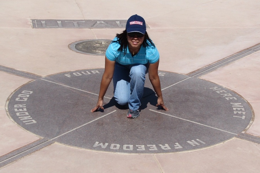
FOUR CORNERS
The only location in the United States where four states, Arizona, Colorado, New Mexico, and Utah, meet in a single spot. Standing on the brass cap allows an individual to stand in four states at one time. In addition to the monument, visitors can experience local food and artistry of native Americans from the dozens of native American vendors located around the monument plaza.
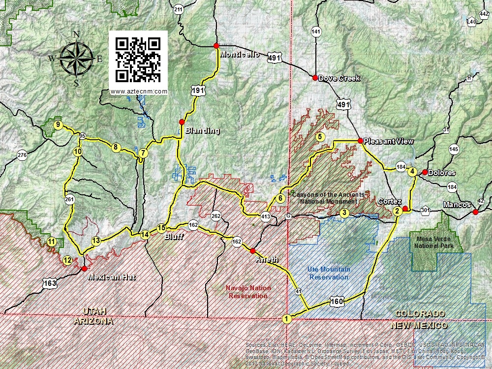
This 116 mile segment of the Trail of the Ancients Scenic Byway covers southwest Colorado.
Cortez
Many consider Cortez the cultural center of Mesa Verde Country. Strong agricultural traditions and Native American heritage characterize this town, located in the valley that is shadowed by Mesa Verde. Ancient cliff dwellings, cowboys and farms mingle harmoniously below the surrounding mountains.
Crow Canyon Archaeological Center 23390 Road K
(800) 422-8975
www.crowcanyon.org
Crow Canyon Archaeological Center is a research center located northwest of Cortez. Their mission is to provide the public an opportunity to learn about archaeology, participate in educational programs and partners with Native Americans in educating the public about past and present cultures.
Technically not on the scenic byway, Canyons of the Ancients National Monument covers a vast region that is surrounded by the scenic byway. The location identified on this map is the main entrance to Sand Canyon which offers plenty of trails to hike, mountain bike and horseback riding. In addition, many of the canyon walls contain cliff dwellings. The main trail through Sand Canyon is easily a half-day hike.
Dolores is a must-stop for anyone who is nearby. A wonderful small town located in a canyon with the beautiful Dolores River cutting along one side and rock cliffs on the other. There are countless opportunities for biking, hiking, fishing, hunting, exploring ancient ruins, white water rafting and much more.
Just northwest of Dolores is the Canyons of the Ancients Visitor Center & Museum (formerly known as the Anasazi Heritage Center). It is a museum that features permanent and special exhibits, archaeological site information, educational resources for teachers and a large research collection from various archaeological projects in southwest Colorado. It is also an ideal starting point for planning visits to the Canyons of the Ancients National Monument. They have maps, guidebooks, and current information about trail and road conditions within the National Monument.
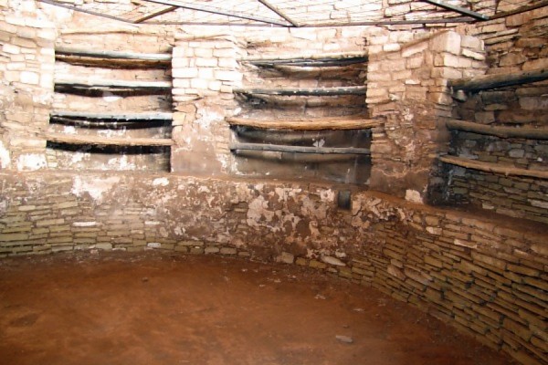
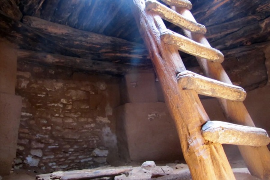
Lowry Pueblo, named after early homesteader George Lowry, was constructed about AD 1060. It was excavated from 1930-1936 by Paul S. Martin of the Field Museum of Natural History in Chicago. Declared a National Historic Landmark in 1967 it is now a part of Canyons of the Ancients National Monument. After re-excavation in 1974, the mural in one of the Great Kivas began to discolor and peel away due to exposure to light and air. None of it survives today, except for a salvaged fragment which is stored at the Canyons of the Ancients Visitor Center & Museum.
This 200 mile segment of the Trail of the Ancients Scenic Byway covers southeast Utah.
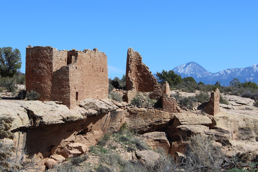
Within this monument are six ancestral Puebloan villages spread over a 20-mile expanse of mesa tops and canyons along the Utah-Colorado border. The main complex and park facility is located in Utah. From this location, one can hike along a trail system on the mesa top to view numerous structure and ruins. A small campground (31 camp sites) is available at a first come first serve basis. Camp sites include tent pads, fire rings and picnic tables with shade structures, however there are no hookups available.
Blanding is the gateway to Utah's Canyon Country. Surrounded by more state and national parks than anywhere else in the United States, Blanding is the perfect base camp for your adventure.
Edge of the Cedars State Park museum houses the largest collection of Ancestral Puebloan (Anasazi) pottery in the Four Corners Area. The museum was built at the site of an ancient village which included dwelling units and a kiva. The kiva and some other structures have been restored and can be viewed behind the museum. The museum offers programs for adults and children, including archeology and art exhibitions, storytelling, and craft workshops.
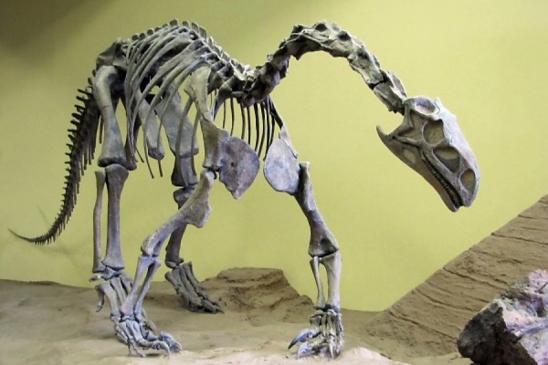
The Dinosaur Museum exhibits a complete history of the world of dinosaurs. Skeletons, fossilized skin, eggs, footprints, state-of-the-art graphics, and beautifully realistic sculptures present the dinosaurs from the Four Corners region.
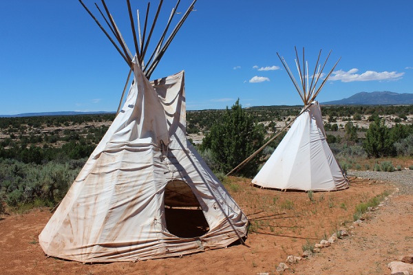
Located at the San Juan Foundation office, the land consists of a vast trail network and small village sites which representative the different cultural groups who inhabited the area: Paiute, Ute, Navajo, Hispanics and Pioneers.
Ute Site.Photo by EMKotyk
Highway 95
This segment of Utah Highway 95 is also part of the Bicentennial Scenic Byway.
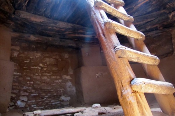
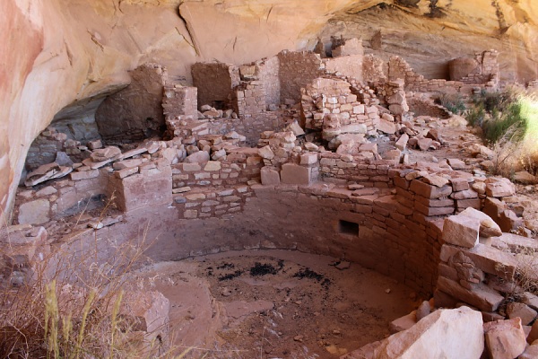
Location is signed on the west side of State Highway 95. A cliff dwelling located in a side canyon of Butler Wash, the ruins were built and occupied by the Ancestral Puebloans, around 1200 AD. Parts of the site has been stabilized and reconstructed, but most of it remains as it was found in the 1800s. There are habitation, storage and ceremonial structures, including four kivas. in a side canyon of Butler Wash, on the east side of Comb Ridge.
Butler Wash Ruins: Main Complex.Photo by EMKotyk
Mule Canyon Cave Towers
Ruins located on the southern side of the highway about 3/4 mile south of the Mule Canyon Trail access road at the head of a tributary to Mule canyon. Single structure exists at the top with additional ruins located in an alcove below.
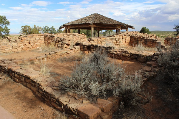
Mule Canyon Ruins
Signed and located directly off of State Highway 95, this is a set of ruins that have been stabilized by the Bureau of Land Management. The ruins were occupied from about A.D. 750 to 1150 (Pueblo I to Pueblo III period). Facilities at this location include a vault toilet, seating, and several educational panels explaining the history and traditions of the Ancestral Puebloans.
Mule Canyon Ruins.Photo by EMKotyk
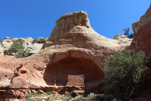
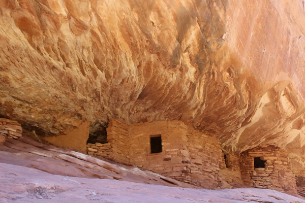
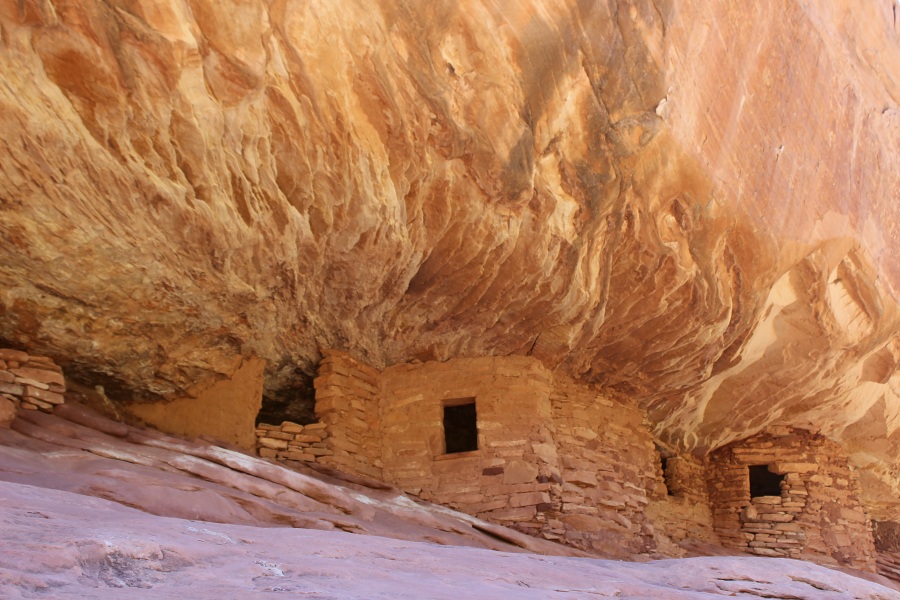
House on Fire Ruins
Access to the trailhead is about 1/3 of a mile east of the Mule Canyon Ruins turn off to the BLM exhibit of Mule Canyon Ruins. Located in the south fork of Mule Canyon, these ruins were occupied around the same time as Butler Wash Ruins. A more back country hiking experience of about a 3 mile round trip hike, these ruins are popular for photographers due to the colors and lighting, especially in the morning.
House On Fire Ruins @ about 10:00 am.Photo by EMKotyk
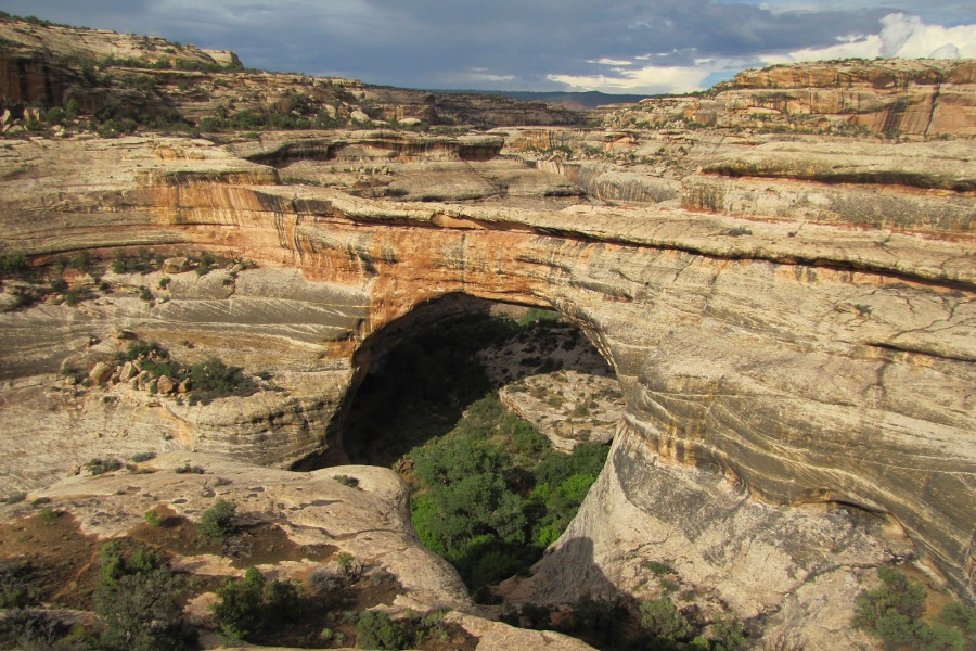
Declared a National Monument in 1908, three majestic natural bridges are named "Kachina," "Owachomo" and "Sipapu" in honor of the Native Americans that once made this area their home. View them from an overlook, or hit the trails and experience their grandeur from below.
Located within the Bears Ears National Monument, this area is well known for its cultural resources. The Ranger Station is at the Kane Gulch Trailhead, which leads into Grand Gulch, where hundreds of Ancestral Puebloan ruins exist in a backcountry setting which is toured by backpackers. Moon House is a remote undeveloped ruin in McLoyd Canyon and is accessible by a strenuous three mile hike and is not for those who fear heights. Numerous other canyons can be hiked as well. The Ranger Station has interpretive displays of photographs, drawings of numerous prehistoric sites, primarily rock art, and of archeologists at work. Rangers are available to answer your questions. Day, Week, and Annual Day Use Permits and Overnight Permits are available there.
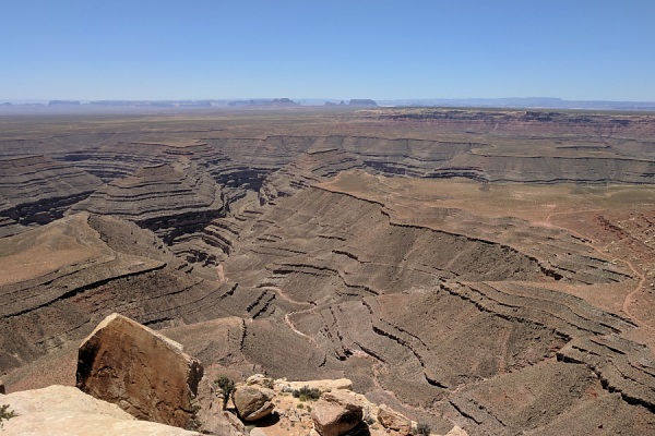
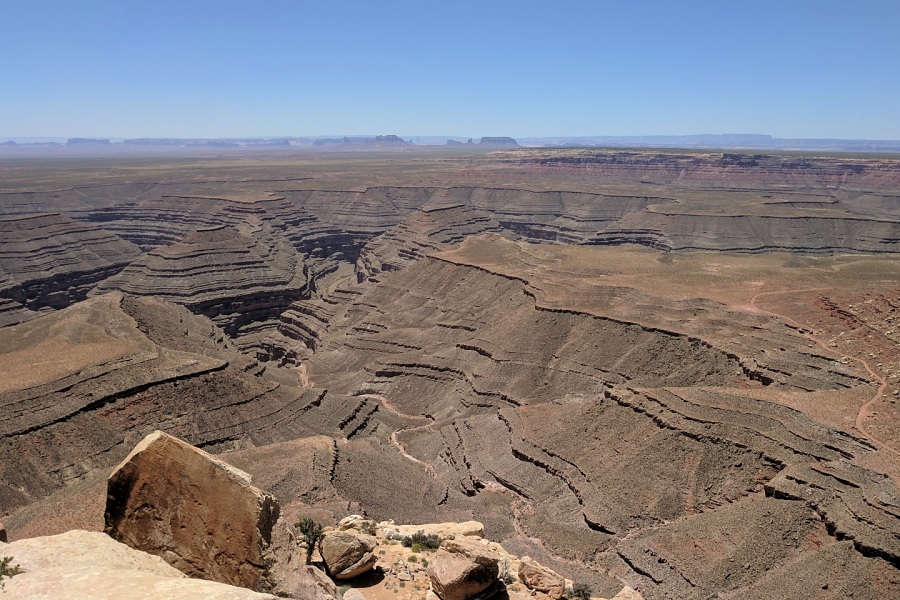
Off the main highway for 5 miles on a dirt road, this lookout point lies on Glen Canyon National Recreation Area lands. This overlook provides a southern overview of the San Juan River, much similar to Goosenecks State Park.
Muley Point.Photo by EMKotyk
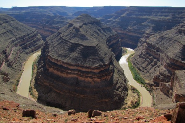
From the mesa top view what took 300 million years of natural San Juan River erosion to create. You will see a 1,000-feet-deep glimpse into the Earth's geological past. Goosenecks State Park offers spectacular views of this amazing and rare geologic formation, known as an entrenched meander.
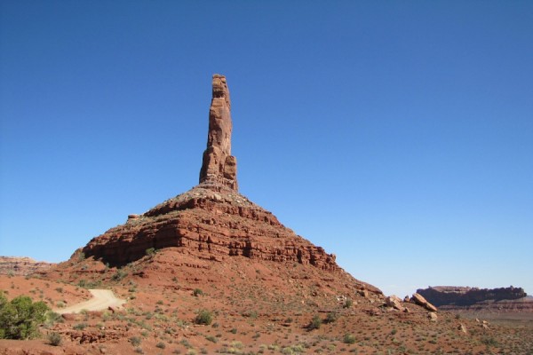
A 17 mile loop, this exceptionally scenic region is a miniature of Monument Valley. Features include towering monoliths, pinnacles, and other geological features that underscore its Valley of the Gods nickname.
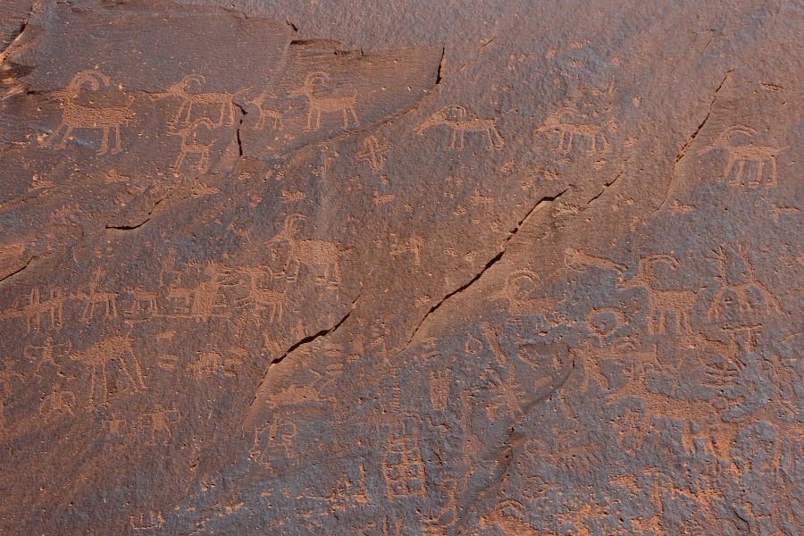
Located west of Bluff at the Sand Island Recreation Area and along the San Juan River, this location consists of a large panel of Petroglyphs that span from Archaic through Ancestral Puebloan and recent times of the Ute and Navajo.
Muley Point.Photo by EMKotyk
Bluff
Bluff is nestled between dramatic sandstone bluffs and the San Juan River on the Trail of the Ancients Scenic Byway in southeastern Utah. Bluff is an artist's community featuring quality lodging, shopping, and dining.
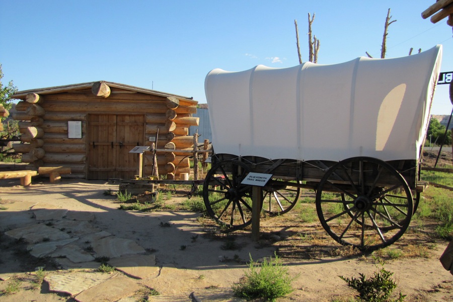
Located near the center of town is Bluff Fort (1880-1883). The original Bluff Fort has been rebuilt and lovingly restored through the efforts of the Hole in the Rock Foundation. It is open to visitors free of charge.One of the original cabins, the Barton Cabin, is present at the Bluff Fort. In addition, replicas of the original log cabins and the meetinghouse have been constructed to give the visitor a glimpse of pioneer life on the San Juan in the 1880's.