Cerrillos Hills State Park Trails

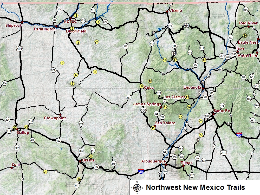
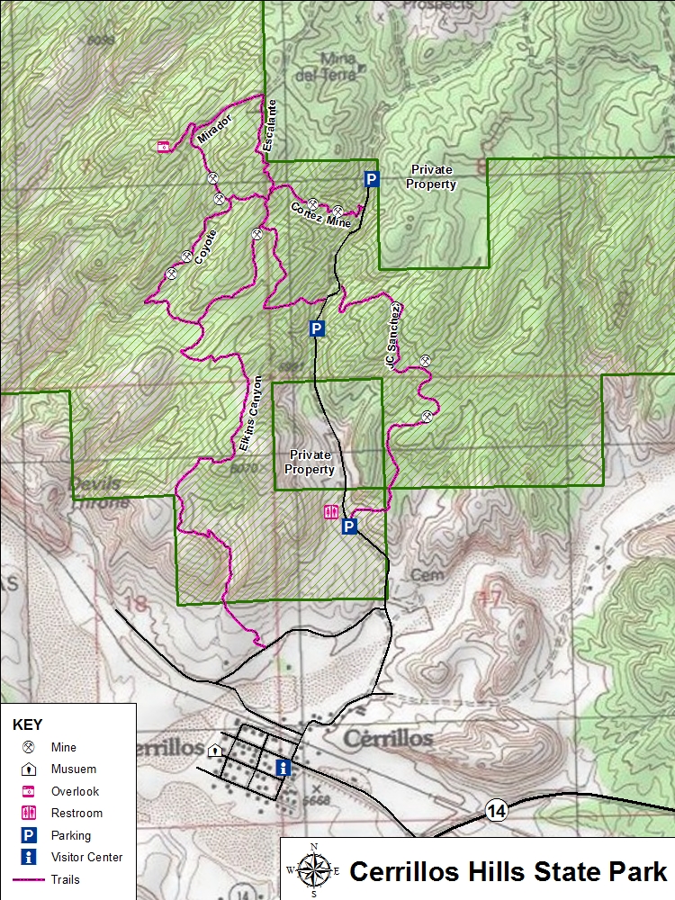
Cerrillos Hills, New Mexico's 35th State Park, is a year-round, day-use park located off the Turquoise Trail National Scenic Byway (State Highway 14) between Santa Fe and Albuquerque.

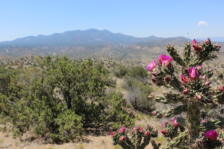
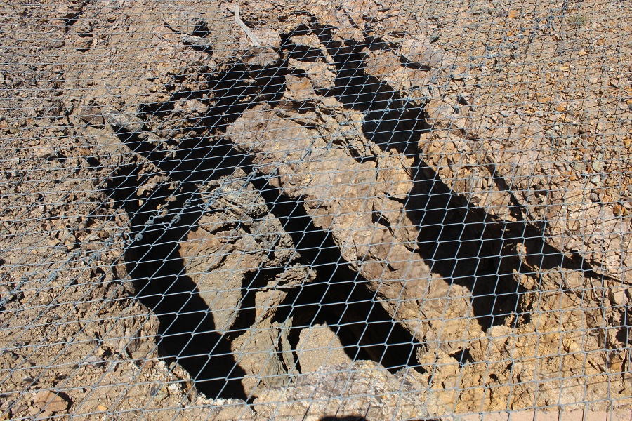
The park has trails for hiking, mountain biking, horseback riding and picnicking. The area offers scenic views of the Galisteo Basin and surrounding areas. One will cross paths with over 1,100 years of mining history. The historic mine shafts are safeguarded and signed with interpretive information. Elevations range from 5,800-6,100 feet.
Trail Name Difficulty Distance Elev. Gain
1. Jane Calvin Sanchez Easy 2.0 mi / 3.4 km 250 ft
2. Elkins Ranch Easy 1.4 mi / 2.3 km 270 ft
3. Coyote Easy 1.2 mi / 2.0 km 80 ft
4. Cortez Mine Easy 0.6 mi / 1.0 km 160 ft
5. Escalante Easy 1.4 mi / 2.4 km 200 ft
6. Mirador Easy 1.0 mi / 1.36 km 130 ft
Cerrillos Hills
Cerrillos Hills State Park Trails Map and Info (PDF 891 KB)

Cholla Blooming
Cholla blooming, Ortiz Mountains in the background.
Cholla Blooming
Cholla blooming, Ortiz Mountains in the background.
Josh Lode Mine
Josh Lode Mine.
Photos by EMKotyk