Dinetah Archaeology
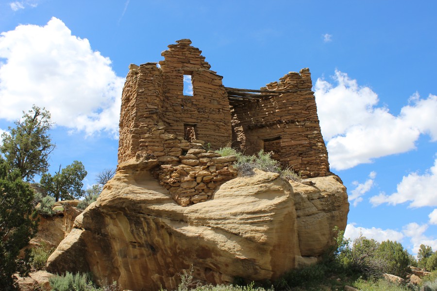
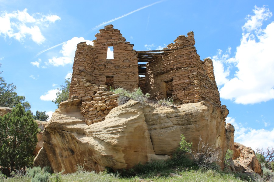
Citadel Pueblito
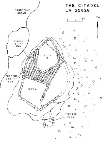
Ceramic Assemblage: Only Dinetah Gray and Gobernador Polychrome wares have been identified at the site (Towner 1997).
Tree-ring Analysis: A total of 16 samples have been collected from the pueblito. Wood species identified only consisted of juniper. About half of the samples showed evidence of metal ax use. Though numerous tree-ring samples have been taken, results were rather disappointing. At best, the pueblito was likely built sometime after 1688 (Towner 1997). The pueblito has undergone some stabilization (Site Signage).
| Land Owner: | State of New Mexico
➠ Create an Account for Recreational Access Form |
| Site Elevation: | 6548 ft / 1996 m |
| Hiking Difficulty: | Easy =
Someone in fair hiking condition; Distance less than 400 feet; Elevation gain less than 50 feet. |
| References: | |
 |
Powers, Margaret A. and Byron P. Johnson 1987
Defensive Sites of Dinetah. New Mexico Bureau of Land Management Cultural Resources Series No. 2, 1987. U.S. Dept of the Interior, Bureau of Land Management, Albuquerque District. |
 |
Towner, Ronald H. 1997
The Dendrochronology of the Navajo Pueblitos of Dinetah, PhD dissertation, University of Arizona. |
More Information
Other Pueblitos
| ➠ Return to Archaeology Page |
Report Vandalism
Report any vandalism to the State Land Office at (505) 326-5716.