Dinetah Archaeology
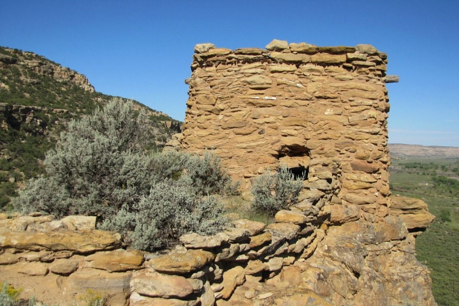
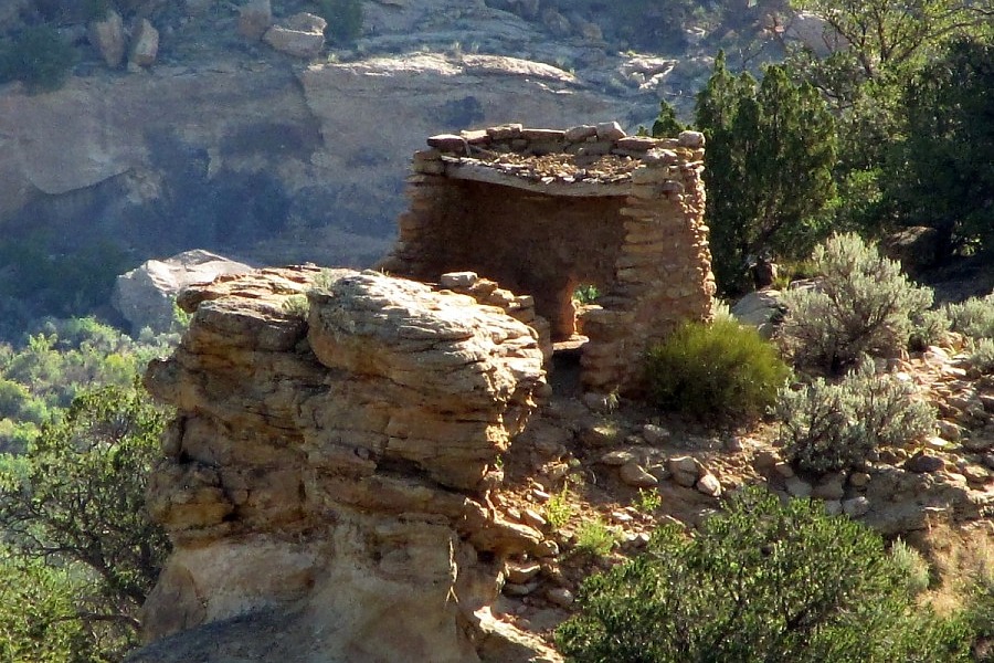
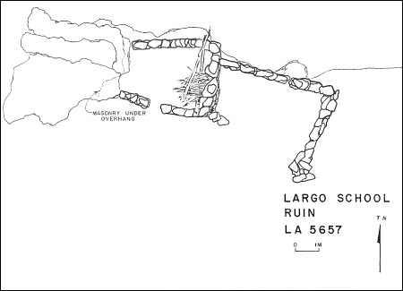
Largo School Pueblito
Ceramic Assemblage: Ceramics documented at the site included Dinetah Gray, Gobernador Polychrome, Jemez Black-on-white, Zia, Santa Ana, and Acoma wares (Towner 1997).
Tree-ring Analysis: Sixteen tree-ring samples have been collected from the site. Unfortunately nearly half of the samples were cottonwood which is not dateable. In addition the high use of cottonwood is unusual for pueblito construction. Based on the limited dates obtained, it is suggested that Room 3 was constructed in 1736 and Room 2 was constructed in 1737. The pueblito underwent stabilization by the BLM in 1975 (BLM site plaque).
| Land Owner: | Bureau of Land Management |
| Site Elevation: | 6395 ft / 1949 m |
| Hiking Difficulty: | Challenging =
Someone in good hiking condition; Distance more than 1/2 mile; Elevation gain 50 to 100 feet. |
| References: | |
 |
Powers, Margaret A. and Byron P. Johnson 1987
Defensive Sites of Dinetah. New Mexico Bureau of Land Management Cultural Resources Series No. 2, 1987. U.S. Dept of the Interior, Bureau of Land Management, Albuquerque District. |
 |
Towner, Ronald H. 1997
The Dendrochronology of the Navajo Pueblitos of Dinetah, PhD dissertation, University of Arizona. |
More Information
Other Pueblitos
| ➠ Return to Archaeology Page |
Report Vandalism
Report any vandalism to the Bureau of Land Management hot line at (505) 564-7600.For in progress incidents, request a BLM Ranger through Non-Emergency Dispatch (505) 334-6622.