
Dinetah Archaeology
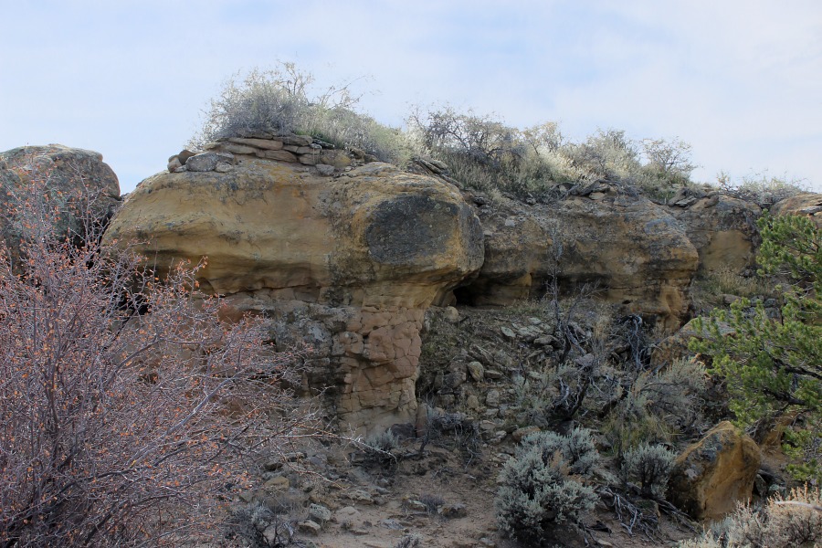
Muñoz Canyon Pueblito
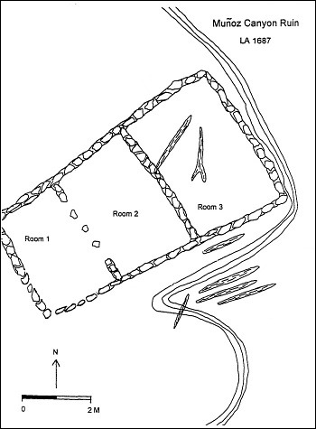
Ceramic Assemblage: Ceramics observed included Dinetah Gray wares and Gobernador Polychrome.
Tree-ring Analysis: Six tree-ring samples have been collected from the site, all of which dated and indicate a construction date of 1743 or 1744. Pinion and juniper is represented among the samples (Towner 1997).
| Land Owner: | Bureau of Land Management |
| Site Elevation: | 6529 ft / 1990 m |
| Hiking Difficulty: | Moderate =
Someone in good hiking condition; Distance about 0.5 mile one-way; Elevation gain less than 100 feet. |
| References: | |
 |
Towner, Ronald H. 1997
The Dendrochronology of the Navajo Pueblitos of Dinetah, PhD dissertation, University of Arizona. |
More Information
Other Pueblitos
| ➠ Return to Archaeology Page |
Report Vandalism
Report any vandalism to the Bureau of Land Management hot line at (505) 564-7600.For in progress incidents, request a BLM Ranger through Non-Emergency Dispatch (505) 334-6622.