Dinetah Archaeology
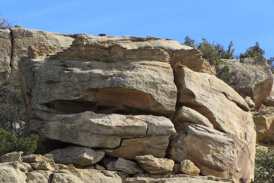
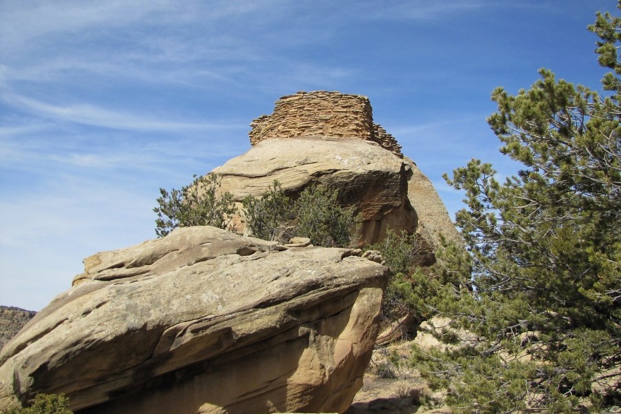
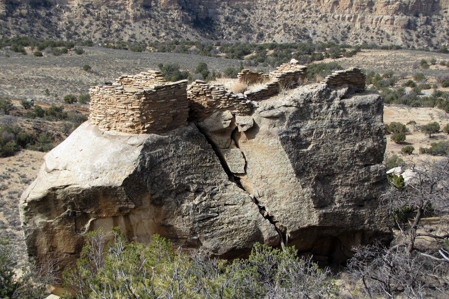
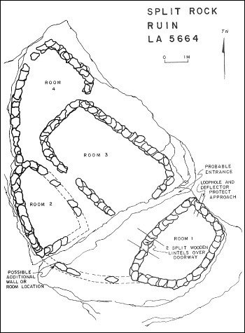
Split Rock Publito
Ceramic Assemblage: Ceramics identified at the site included Dinetah Gray, Gobernador and Frances Polychrome, Puname (Zia Pueblo) Polychrome and Acoma Matte wares.
Tree-ring Analysis: Eight tree-ring samples have been collected from the site. Four of the samples had evidence of metal ax use. Dates obtained from the samples proved to be inconclusive. At best two non-cutting samples indicate an occupation probably sometime in the mid-1720s (Towner 1997).
| Land Owner: | Bureau of Land Management |
| Site Elevation: | 6585 ft / 2007 m |
| Hiking Difficulty: | Easy =
Someone in fair hiking condition; Distance less 1,000 feet; Elevation gain less than 20 feet (to the base of the boulder). |
| References: | |
 |
Powers, Margaret A. and Byron P. Johnson 1987
Defensive Sites of Dinetah. New Mexico Bureau of Land Management Cultural Resources Series No. 2, 1987. U.S. Dept of the Interior, Bureau of Land Management, Albuquerque District. |
 |
Towner, Ronald H. 1997
The Dendrochronology of the Navajo Pueblitos of Dinetah, PhD dissertation, University of Arizona. |
More Information
Other Pueblitos
| ➠ Return to Archaeology Page |
Report Vandalism
Report any vandalism to the Bureau of Land Management hot line at (505) 564-7600.For in progress incidents, request a BLM Ranger through Non-Emergency Dispatch (505) 334-6622.