
Dinetah Archaeology
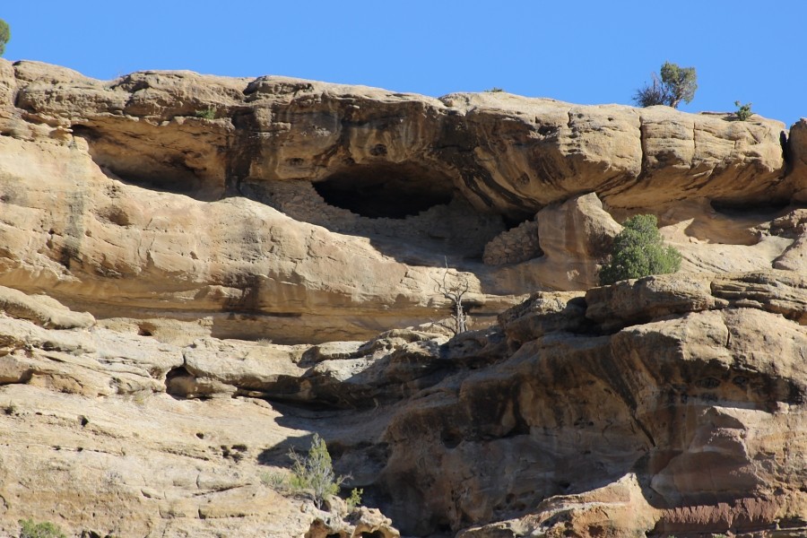
Christmas Tree Ruin
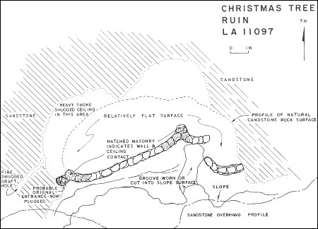
Ceramic Assemblage: Ceramics observed included only Dinetah Gray wares (Powers and Johnson 1997).
Tree-ring Analysis: No tree-ring samples are available for this site.
| Land Owner: | Bureau of Land Management |
| Site Elevation: | 6000 ft / 1828 m (estimated) |
| Hiking Difficulty: | Access to the site is not possible from the canyon. |
| References: | |
 |
Powers, Margaret A. and Byron P. Johnson 1987
Defensive Sites of Dinetah. New Mexico Bureau of Land Management Cultural Resources Series No. 2, 1987. U.S. Dept of the Interior, Bureau of Land Management, Albuquerque District. |
More Information
Other Pueblitos
| ➠ Return to Archaeology Page |
Report Vandalism
Report any vandalism to the Bureau of Land Management hot line at (505) 564-7600.For in progress incidents, request a BLM Ranger through Non-Emergency Dispatch (505) 334-6622.