Dinetah Archaeology
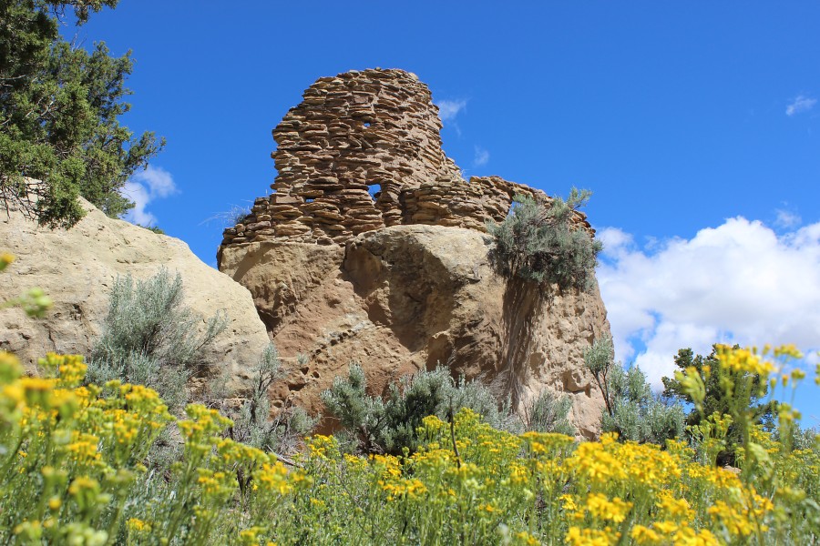
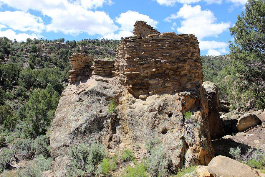
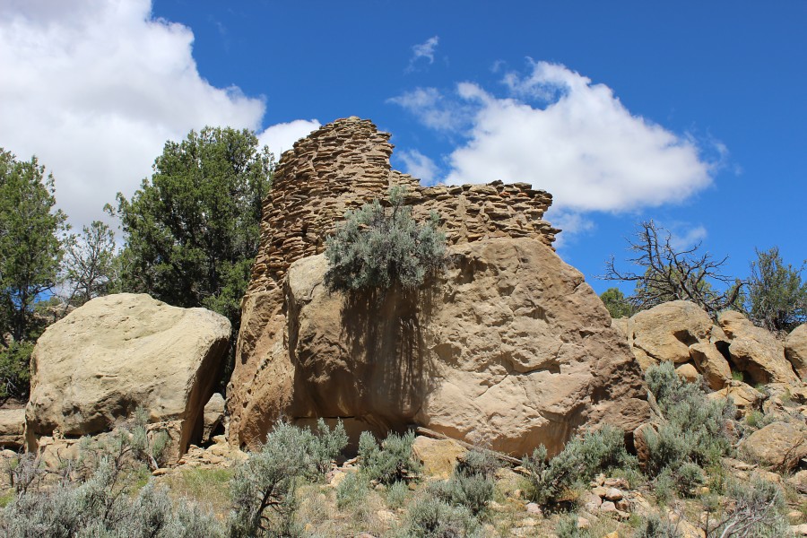
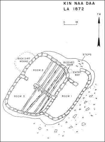
Kin Naa Dáá (Maize House) Pueblito
Ceramic Assemblage: Ceramics previously identified include Dinetah Gray, Gobernador Polychrome, Payupki (Hopi) Polychrome, and Ashiwi (Zuni Pueblo) Polychrome.
Tree-ring Analysis: Sixteen samples were collected from the pueblito. Pinyon and juniper was used and evidence of metal ax use was found on almost every sample. Date clustering of samples indicate that the pueblito was constructed in 1727 (Towner 2003).
| Land Owner: | Bureau of Land Management |
| Site Elevation: | 6500 ft / 1981 m |
| Hiking Difficulty: | Very Difficult =
Someone in excellent hiking condition; Distance less than 1,500 feet; Elevation gain > 300 feet. |
| References: | |
 |
Powers, Margaret A. and Byron P. Johnson 1987
Defensive Sites of Dinetah. New Mexico Bureau of Land Management Cultural Resources Series No. 2, 1987. U.S. Dept of the Interior, Bureau of Land Management, Albuquerque District. |
 |
Towner, Ronald H. 2003
Defending the Dinetah: Pueblitos in the Ancestral Navajo Heartland. The University of Utah Press, Salt Lake City, Utah. |
More Information
Other Pueblitos
| ➠ Return to Archaeology Page |
Report Vandalism
Report any vandalism to the Bureau of Land Management hot line at (505) 564-7600.For in progress incidents, request a BLM Ranger through Non-Emergency Dispatch (505) 334-6622.